Tuesday, April 26, 2011
Shameless Self-Promotion
Hey, I have a new blog. Check it out: http://www.alonghistoryofhardlyanything.blogspot.com/
Sunday, October 3, 2010
Home
My plane landed at the Atlanta airport on August 2nd, around 1pm. It had been a rough, restless night of travel, flying from La Paz to Santa Cruz, then catching a connection to Miami at 1am.
My first move upon arrival to Atlanta was to order a meatloaf lunch and sweet tea from the Paschal’s just outside the security gate. Then, I sat down in one of the big lounge chairs in the rotunda beside the food court to people-watch for an hour or so, and take some notes in my journal.
Two months later, I’m still taking notes and reflecting back a little bit on my Peace Corps experience and Post-PC travels. This will be my last post to this blog.
My PC story is probably not completely over, but this seems like a good a time as any to wrap things up.
Here are a few of the main things, worded as simply as possible, that I’ve taken away from my PC experience:
• Be Bold in Your Aspirations. Looking back at my own life, I have failed at very few things that I have put my mind to. PC is another event that I would consider an amazing success. In general, this is of course very positive; however, now and in the future I would like to fail a little more often, and in doing so, achieve great things. Life is full of the unexpected, and it took a handful of farmers in rural Costa Rica to make me reassess what I am capable of.
It’s like Theodore Roosevelt said: “Far better it is to dare mighty things, to win glorious triumphs, even though checkered by failure, than to rank with those poor spirits who neither enjoy much nor suffer much, because they live in that grey twilight that knows neither victory nor defeat.”
Okay…so Roosevelt’s wording is a little grandiose, but I like his rhetoric. My failed ascent of Mt. Chimborazo during my travels in Ecuador also have helped to drive his point home.
• Life is a Journey. Enjoy it. While we must always have an eye out for what lies ahead, and create compelling visions of our future path, day to day we must live in the present. Enjoy each sip of coffee, take pride in every key typed in that long report, and never forget how important the bonds of friendship and family are to us.
• Know yourself. It sounds so simple, but it is an idea oft repeated in history and popular culture:
“Know thyself” - Socrates
“This above all, to thine own self be true” - Hamlet, Shakespeare
The degree to which we can understand ourselves determines our ability to move through life with less friction. Knowing oneself, a person can make decisions that allows them to fight their own tendencies less, and move more freely through life, whether in work, love, or other situations. This is a life-long undertaking.
I didn’t do PC expecting it to change me in any fundamental way, but it definitely has. It has something to do with the challenge of it all. Spending two years in a small village in a different country with little access to technology can be a very solitary endeavor.
At times you feel extremely isolated from friends and family, and unable to relate to the people you see on a daily basis in the country where you serve.
Ultimately, the neverending series of challenges led me to a lot of introspection. I was brought face-to-face with myself – the strengths and the weaknesses, for better or worse.
In my experience, I have found that if you can be kind enough to yourself during all those trials, then you will eventually leave with a better knowledge, and appreciation, of who you are. This is one of the best things any individual can do.
For any friends or family, future Peace Corps volunteers, or anyone that just happens to stumble upon this website, if you ever would like to get in touch, feel free to contact me via email at blake.hen@gmail.com.
Until then, enjoy the journey.
Friday, July 30, 2010
Silver Mines and Salt Flats
I arrived to La Paz about two weeks ago, still shivering from the winds off Lake Titicaca, and with the added disappointment of being turned down from the first three hostals whose doors we knocked on.
I say we, because I had been traveling with a Portuguese girl, Nora, who I had met in Machu Pichu and ran into again at Puno, on the Peruvian shore of the lake. Seeing as we were both traveling alone and in a strange new country, we decided to join forces for a few days.
In La Paz, I just had to stay warm and keep my spirits up long enough to receive reinforcements; or that is, one of my best friends from Peace Corps, Josh Kagan, would be flying in to meet me and travel for a couple of weeks in Bolivia before returning to the United States together.
Josh was arriving at an extremely opportune time, as I was feeling a bit worn down by the Bolivian winter, a cold that had been hounding me for several weeks, and the numerous discomforts of being on the road for over two months.
I can count on one hand the few people that I can handle traveling abroad with for prolonged periods of time. These are friends that I can arrange to meet with on a certain street corner, at a determined time, halfway around the world, with about 99% certainty they will be there at the appointed hour.
Josh was one of those few. He is fluent in Spanish, extremely flexible, has a great sense of humor, and possesses a common sense that is essential for traveling.
We had already traveled together often in Nicaragua and inside of Costa Rica during Peace Corps. On a busy street in any given Latin American city, trying to plot a course, a couple quick words or a head nod in one direction is usually all the communication that is necessary between us. (When in a new city it´s always best to at least give the illusion you know where you are going at all times.)
On Monday July 19th, at the agreed upon hour of 9am, I walked into a hostal in downtown La Paz and found Josh sitting in a chair in the courtyard, exactly where he said he would be.
¨Heayygghh man¨, Josh greeted me! He got up, and I walked over to give him a hug and a couple of bro-pounds on the back. It had been more than two months, since our last day in San José, Costa Rica in May, when I´d seen him last.
But something was wrong. He sounded terrible. His voice hoarse and barely audible.
It turned out Josh had spent a hard two nights of partying in Washington D.C. with friends before catching the red-eye flight on Sunday night down to Miami, and then La Paz. The nights on the town and the late flight had coincided with a cold that had been brewing for a few days, and seemed to have completely matured by the time of our greeting in La Paz.
So instead of the cavalry, I got a wounded foot soldier limping into battle. Instead of a fresh and rested Mariano Rivera coming in for the save, I had an injured and bloody Curt Schilling trying to pull out the win.
Okay, I jest. Josh was still coming in to help me finish in style the last two weeks of what has been an incredible trip. He would just need a couple nights rest and a few days of antibiotics to get back into form.
Unfortunately, the rest never came. Our first night was spent in, for all purposes, appeared to be a cold, attic at a hostal/Irish pub we stayed at in La Paz. Josh´s condition only worsened.
Our second night, resolving to get the hell out of La Paz, we boarded a night bus to take us down to the mining town of Potosí. A huelga, or strike, on the main road south from La Paz to Uyuni had forced us to change our plans slightly, opting to see Potosí first, and then the Salt Flats outside of Uyuni.
We fared better on the night bus to Potosí then in the cold attic in La Paz, and around 6am we rolled into the Potosí bus terminal. We quickly hopped into a cab that took us to the downtown, found decent lodging with heating, and then quickly laid down for a nap as soon as we entered our room.
Everything I had read about Potosí fascinated me, and frankly this small, little-known town was one of the main reasons I wanted to visit Bolivia.
Potosí is known as the highest city in the world, set at an elevation of around 4,100 meters. It is also the location of Cerro Rico (or the rich mountain), the most productive silver mine the world has ever known.
The Spanish discovered silver there in 1544, and deciding it warranted immediate attention, set up a mining operation around the cerro. For the next three centuries the Spanish would remove more than 45,000 tons of silver from the mountain.
Potosí would become the Spanish empire´s principal source of silver, financing its numerous wars, and causing the first prolonged inflation in Europe since the Dark Ages as a result of expansion of the money supply.
To work the mines, the Spanish employed a system known as mita, or forced labor by the local indigenous populations, as well as by black slaves brought in from Africa. The miners would work extremely long hours, up to 12 hours a day, and at high temperatures extracting ore from under the mountain. To sustain themselves, the miners chewed enormous quantities of coca leaves and drank alcohol, in nearly pure form, to keep them working. They would stay under the mountain working for ¨shifts¨ of up to four months, finally emerging to the outside world only by placing bandages over their eyes, which were completely unaccustomed to the sunlight.
The majority of the miners would perish of psilicosis pneumonia after less than 10 years working in the cerro. It is estimated that in the three centuries of Spanish mining, as many as 8 million indigenous and black laborers perished as a result of the mita system.
Potosí itself became a center of great importance. In the late 1600´s, the city had a population of over 200,000, larger than either Paris or London at that time. It was home to architecture and fine art, with more than eighty churches built within the city perimeter.
Today, Potosí is still a mining center, but on the decline, with a population of roughly 120,000, or 80,000 less than at its height. The conditions in the mines also have improved immeasurably, right?
Wrong. Actually the miners still work under extremely difficult conditions, although they are now organized under cooperatives, and largely reap the gains from their own labor.
On our second day in Potosí, Josh and I took a tour of the Potosí mines. Our guide was a young man, of about our own age, who had 15 years experience working in the mines (he began when working with his father in the mines when he was about 12 years old). He picked us up around 9am from our hostal, and led us to our first stop, a small road-side supply center for miners.
There, in an alley not far from the center of Potosí, we bought supplies and gifts for the miners - things like coca leaves, small flasks of alcohol, liters of soda, and a few sticks of dinamite.
Well provisioned, we continued on to the mines, where we were given helmets, head lanterns, and full clothing to cover us from the soot and dust of the mine. Once we were prepared, we entered a mine shaft.
We proceeded slowly along the shaft, at the farthest point in the tour reaching more than 700 meters, or more than 2000 feet into the mine. As we walked further into the mountain, we would constantly have to stop our movement and cling to the sides of the tunnel, as working miners continued by us moving their mining carts filled with materials on small railways. The temperature also reached up to 90 degrees Farenheit as we went further under the mountain.
I had never been in a mine shaft before, much less in a working mine. The miners walking by us had their cheeks full of coca leaves, used to give them more energy and allow them to handle the hard labor. They also drank regulary from small, plastic flasks of alcohol, which we tried and tasted almost completely pure, much like rubbing alcohol.
During the rest of tour, which consisted of more than two hours underground, we were shown small temples the miners had erected in side shafts, where they would take breaks and make offerings to the idols. We were also shown veins of silver and tin that the miners were still working.
Once we´d exited the mine shaft, our guide gave us a dinamite demonstration. He showed us how the fuse was connected to the dinamite stick, and after lighting the fuse, insisted we all pose for a photo with the lit dinamite. We all hurried to comply. Finally, he took the dinamite to a site about 40 meters from us, laid the stick of dinamite on the rock surface outside of the mountain, and then continued in the other direction to await its explosion. The resulting concussion took the air out of our lungs.
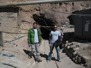
Josh and I outside of the mine shaft.
Having satisfied my curiosity of Potosí with the mine tour, Josh and I continued on the next day to Uyuni, farther southwest near the border with Chile. Uyuni is traditionally the place where groups contract tours of the neighboring salt flats and Parque Laguna Colorado. And so we were going to Uyuni to do just that.
We awoke the morning after arriving to Uyuni and quickly contracted a company to give us a tour of the salt flats. The tours are done by 4x4 Land Cruiser, meaning the tourists hire a driver/guide to take them out into the salt flats and beyond to the national park. The normal tour these days takes about 3 days and covers over more than 500 kilometers during the tour.
The three day tour was amazing. We saw landscapes that I would have never even been able to imagine. We were basically touring a desert located at 4,000 meters of altitude. The surrounding scenery was desolate and bleak, but beautiful at the same time. We traveled through one of the world´s largest salt flats, saw red volcanic mountains, and green salt lakes at nearly 5,000 meters of elevation. I have never seen anything like it.
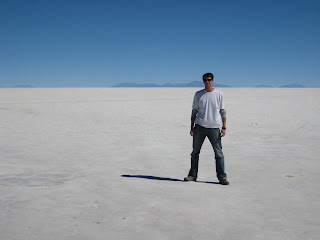

Some scenes from the tour.
We also made some great friends on the trip. Of the three other people sharing the Land Cruiser with us there was a Swedish couple, Marco and Eva, and a young New Zealander doing some touring after she spent almost two years in the UK. They were a lot of fun to hang out with, and I think we all left extremely happy with the experience.
After a rough 3 days in the Land Cruiser and putting up with the cold (temperature reached down to 0 degrees Farenheit at night), Josh and I have continued on to Sucre.
Sucre is a beautiful colonial town, located at roughly 2,700 meters of elevation, with pleasant weather, beautiful Spanish architecture, good restaurants, and a live University scene. Here we have been relaxing for a few days before heading back to La Paz to complete our time in Bolivia.
This afternoon we board a night bus back to La Paz, and then after a couple of lazy days buying souvenirs in the capital, will board flights back to the US on Sunday night.
Going Home
For me I find it hard to believe, and even a little saddening, that my adventure is coming to a close. That said, I´m extremely proud of the things I´ve seen and done during the last few months.
In less than three days, I will land back in Atlanta, which should be quite a shock, moving from a Bolivian winter to the southern heat, not too mention all the cultural factors.
Once home, I hope to take some time to reflect on the last two and a half years in Latin America, and try to share some of these ideas via the blog.
Saturday, July 17, 2010
Choquequirao and Machu Picchu
What is Choquequirao?...you might be thinking. When thinking of Peru and the Incan civilization, most people instantly bring to mind Machu Picchu.
Choquequirao is an ancient Incan city that was abandoned shortly after the arrival of the Spanish in the 16th century. Now all that remains are the ruins of the village, and some pretty extensive terrace work. It is very difficult to access the ruins today, the only way being a 32 kilometer hike (64 kms round trip) deep into the mountains southeast of Cusco.
Most people doing treks around Cusco opt for the famous Inca trail, a 4 day hike on an old Incan road through various Incan ruins leading up to Machu Picchu on the final day. This is a great hike, don´t get me wrong, but my friends and I wanted something a little more off the beaten path. On any given day, up to 500 people can be hiking the Inca trail at the same time.
Knowing this, my friends Kayla, Tamara, Farhat, and I contracted a guiding service a couple of months ago to lead us to the more removed Choquequirao. Normally we are pretty budget travelers, however, in this case we spared no expense.
On Thursday, July 8th we set off on the trail to Choquequirao from the small town of Cachora, about 4 hours southeast of Cusco by car. Our team was made up of 12 people - the four of us, three other Americans, our guide, three mule drivers, and a cook.
Our packs, sleeping bags, cooking equipment, and all other equipment were carried by six mules. The mules allowed us to only have to worry about carrying small day packs with water, snacks, sunblock, and other odds and ends weighing no more than 2-4kilos.
Despite having the mules, and walking on a good trail (the Choquequirao trail was built in 1994 with the help of a $5 million grant from the French government), the hiking through the mountains at an altitude of around 3,000 meters was still extremely challenging at times. The first day of hiking we did 21 kilometers, the last 9 kilometers being a steep ascent down to a footbridge alongside a river.
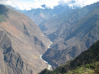
View of the valley we trekked down and out of to reach the ruins of Choquequirao.
Upon arriving to our campsite each day, we would be greeted by the mule drivers, who had gone on ahead, setting up our tents and laying our packs on a tarp for us to pick up. They would direct us to a shower house nearby while they and the cook began working on our meal. Like I said...we spared no expense for this trek.
After showering, getting into clean clothes, and some stretching, we would have our supper. Each meal usually consisted of 4 courses - an appetizer (such as bread), followed by a soup, then the main course, and a dessert. The food was pretty darn good.
I should probably introduce our company on this hike, which was so important to making the experience what it was. Our three co-hikers and guide were:
Mike - 70 years old, from Santa Barbara, California. Currently, an economics teacher at a local community college, he had spent his entire career in higher education, specializing in history and political science. Fluent in Chinese, and extremely well traveled, Mike was also a strong hiker. Several years before he summited Mount Kilamanjaro in Africa with his son.
Nancy - roughly 60 years old, from Durango, Colorado. She is a teacher at a local Montessori school located on an indian reservation. Nancy was also an avid hiker, hiking regularly around Durango, and also having done trekking in Nepal. Nancy was a free spirit. Her daughter seems to have a similar personality, and is a rafting guide on the Colorado River.
Patsy - Nancy´s sister. She currently lives in Encino, California, and is around the same age as Nancy. She and her husband are retired.
Alex - Our guide, age 34. He has an American girlfriend that he met while on the train back from Machu Picchu one day. He has a son with her, and his dream is to get a work visa to the United States, and eventually become a citizen, to be with his girlfriend and son.
From the start there was a mutual respect and interest between us. I think Mike, Patsy, and Nancy really enjoyed our company and sense of humor, while Kayla, Farhat, and Tamara and I loved to hear of their experiences, and also respected their physical strength as hikers.
On the second day of hiking, we got started around 5am and knocked out the remaining 11 kilometers to reach the Choquequirao ruins. The second day included an ascent from the river of roughly 1000 meters over 7 kilometers, which was pretty challenging.
Our third day was dedicated entirely to exploring the ruins. During the tour of some of the terraces, I kept pressing Alex, ¨but how much of this has been restored?...which parts?¨. Some of the terraces where in extremely good shape, the local workers were even growing corn on some of them, and I really wanted to know what the stonework looked like without any restoration work.
At the bottom of an extensive set of terraces I was finally able to satisfy my curiosity. The land below the bottom step of terraces seemed to give way to thick vegetation and trees, but upon closer inspection, the terraces continued! They continued not just one or two levels lower, but as many as 15 levels below!
¨I´m going down,¨ I informed the rest of the group. Alex advised me to be careful, watch my footing, and keep my walking stick in front of me to scare away snakes.
I slid down a hole in the vegetation where some old Incan steps and drain continued downward from the restored terraces above. Finally getting down a level, I could see that the stone terracing, the steps, and drainage system had held together very well! All that was need to do to restore them was rip away bushes and other plants that had established themselves in the walls, and then perhaps apply a layer of mortar on top to protect the wall.
It fascinated me to see the design and craftsmanship of a set of Incan terraces that had not been touched in 500 years, but were still in good condition.
After leaving the terraces, we went up to explore where the main town was situated. We toured a home of what used to be Incan royalty, saw an old Incan bath, and checked out a huge building that appeared to used for gatherings and assemblies. The acueduct which supplied water to the town was still intact, and recently restored, although water had not yet been routed through it. A cut could be seen in the vegetation running from above the town, over to a waterfall where the water used to be routed to the town.
In all the ruins we visited during our time around Cusco, it was always impressive how advanced the Incans were in the central planning of their towns and cities. Their architects would always arrive to an area, determine how the aqueduct could be built to bring water for consumption and agriculture, decide where the religious temples would situated, what areas would be used for homes, and what areas would be terraced for agriculture.
One of the highlights of Choquequiroa was that we were pretty much alone with the ruins. As we toured the hike, there were probably only another 20 people in the area, and most of them spread out across the site.
The fourth and fifth days were spent hiking out back to Cachora, another 32 kilometer journey. Following the hike, we had lunch in Cachora, and presented our guide and other crew members with our thanks and tips. We took a group picture outside of the little shop we used as a base in Cachora.
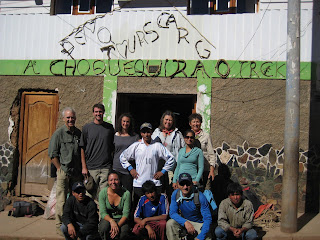
The entire team after a successful hike.
That night, the seven of us and Alex decided to meet up for dinner in Cusco, where we shared one last meal and said our goodbyes. Some special friendships had been formed between members of the group. Kayla, Tamara, Farhat, and I now know we always have a place to stay in Durango and parts of California.
The Choquequirao hike has been my favorite experience during this adventure, mainly for the quality of people in our group.
Following the trek, there was one thing left to do around Cusco...visit Machu Picchu. Farhat and I still had not been to visit the ruins for which the region is famous for, and that are known worldwide.
After a day of rest in Cusco, Farhat and I took a taxi about an hour and a half to Ollantaytambo, where we boarded a Peru Rail train which would take us to Aguas Calientes, the town at the foot of the Machu Picchu ruins.
Once in Aguas Calientes, we found lodging, bought our pass to the ruins, and turned in early. Aguas Calientes is mostly a town where people stay for 24 hours, purely for the purpose of visiting the Machu Picchu ruins.
Around 3am Farhat and I woke up, gathered our things, and began the walk to the foot of the mountain where the ruins are located. To get up to the entrance to the ruins, one has to walk up a set of 1,608 stone stairs, which lead up to the ancient city.
We hiked up the stairs at a brisk pace, and around 4:40am reached the gates to the ruins. We were in the first dozen to arrive to the gates. As we arrived we were greeted with nods of encouragement or greetings of ¨welcome¨ by our early-risers. It was a motley crew from all over the world - French, Spanish, Swedish, Japanese, and other nationalities.
The reason for arriving so early is that the first 200 people to arrive are given a special pass to climb the Waynupichu mountain situated next the ruins. From the top of Waynapichu, one can see the ruins as the first light of the sun hits it.
We were let into the park around 6:30AM, and hustled over to the entrance to Waynapichu. Around 7AM we were admitted to Waynapicchu, and began to make the climb up on the winding staircase built by the Incas. I was the 4th person to reach the top, and the view was well worth it.

Looking down on Machu Pichu from the top of Waynapichu.
After resting for around 45 minutes at the top of Waynapichu, and taking numerous pictures of the ruins, we descended back down to the ruins of the main city. We took a one hour tour of the main sites, and then sat tired against a set of terraces to eat a lunch we had packed.
Around 1:30pm we left the park and descended back down the stone steps to Aguas Calientes, and at 3:30pm we caught a train back to Ollantaytambo.
Machu Picchu was incredible, but I left their feeling not so much euphoric, as relieved. A visit to Machu Picchu is a homage any serious South American traveler must make, and I felt like it had been hanging over my head.
Having satisfied the Machu Picchu visit, I felt free to continue on to other exploits with a clear conscience.
Upon arriving back to Cusco that night, I quickly hopped a night bus to Puno, a town alongside Lake Titicaca, and close the border with Bolivia. In the morning the next day I took another bus to the border, payed the requisite $135 entry fee for Americans (instituted two years ago by the Bolivian government in retaliation for various American foreign policies and the difficulty of entry into the US for Bolivians...the Europeans did not have to pay this), and successfully making the border crossing, continued on in bus to Copacabana.
Copacabana is also situated on the banks of Lake Titicaca, only on the Bolivian side. The conditions have been terrible since arriving here, with bitter cold and harsh winds creating high white-caps on the lake surface.
I had intended to make a trip out to the Isla del Sol, but woke up this morning to evaluate the conditions, and finding them not much changed, have decided to press on to La Paz, only 3 hours away.
As if to confirm the correctness of my decision, I was drinking coffee this morning inside a local café watching the light drizzle, when I realized it had begun to snow lightly. The café owner, a local, was mesmerized and said the conditions were some of the worst he has seen in 5 years.
Lake Titicaca, situated at around 3,800 meters of altitude, is the largest lake in South America, and one of the highest in the world. I would love to explore it more, but unfortunately it doesn´t look like that will happen this trip.
So onward to La Paz.
Monday, July 5, 2010
Climbing Chimborazo
Where the last blog left off I was commenting on my intent to summit the tallest peak in Ecuador, Volcano Chimborazo, at a height of 6300 meters. The climb happened...although not necessarily with the result I had imagined.
Looking back, it seems like I was due for a reckoning during this trip. I had cruised smoothly through Panama, Colombia, and parts of Ecuador. I was meeting people, seeing amazing sights, but not really ever being seriously challenged by anything I came across. Attempting to climb Chimborazo changed all that.
On a Wednesday morning I walked into a local guide agency to try to find out how to climb the mountain. Our conversation went something like this:
Employee: Buenos dias!
Me: Buenos dias! I´d like to find out about how to climb Chimborazo.(in Spanish)
Employee: Okay, what kind of hike do you want.
Me: I´d like to go all the way to the top.
At that, the two people behind the desk sat up a little straighter. One of them, a young guy, introduced himself to me as Franklin Barca. I didn´t know this at the time, but Franklin and I were about to get to know each other very well.
Franklin, age 28, was an alpine guide and medical student studying emergency mountain medicine. He had been guiding for four years, climbed several of the tallest peaks in the Andes, including the tallest (Aconagua, at 6,800 meters, in Argentina), and had summited Chimborazo over 40 times.
There in the office we talked a little bit about what I had in mind, and we decided on a practice hike that Friday, followed by a hike to the summit on Saturday night.
We spent almost the entire next 3 days together. On Thursday, we went and checked out equipment, and on Friday we took a trip up to the mountain for a practice hike up to 5,300 meters.
Something I really didn´t have clear in head as all these planning steps took place, was that climbing Chimborazo was serious mountaineering. We would be trekking upwards through ice and snow, and into very thin air with the summit at an altitude of over 20,000 feet. We would be wearing heavy mountaineering boots with crampons, thick snow clothing, a harness, helmet, head lantern, and I would be carrying a heavy snow pick throughout the hike.
The seriousness of what I was about to attempt dawned on me following our practice hike on Friday. We took a public bus up to the entrance to the park, walked about 6 kilometers up to the refuge at 4800 meters where we would begin the summit hike, and then after a short break, continued on a point above the refuge around 5300 meters where the snow starts to cover the landscape.
The hike from the refuge to 5300 meters left me doubled over, gasping for air every 50 meters towards the end. And once we´d reached our goal, I looked up at the mountain still towering above us, covered in snow with wind whipping around its sides, and for the first time felt strong pings of self doubt. Would I be able to do this?
I spent that night alone in my hotel room, trying to steel my nerves and insist to myself that everything would be fine; that maybe, the mountain is not really as challenging as it looked. I decided I would not look up at the summit during the hike, as it only served to make me more anxious.
The next day, at around 4pm Franklin and I were transported in truck by the guiding agency up to the first refuge at 4800 meters. There our planned schedule was to eat ¨dinner¨ at 4:30pm, rest from 5 to 10pm, wake up for ¨breakfast¨ at 10pm, suit up afterwards, and then begin our hike at 11pm at night.
I did not know this prior to preparing for this hike, but the summiting of most high peaks is done at night...or at least the majority of the ascent. The weather conditions are generally calmer at night, with less wind and snow. Due to our timing, we would also have the benefit of a near-full moon.
So at approximately 11:15pm, having eaten a light breakfast and put on all our gear, Franklin and I opened the door to the refuge and set foot outside to begin our ascent.
I felt great. I was rested, had a light meal in my stomach, already pretty well acclimated to the altitude due to the practice hike and our pre-hike rest, and felt comfortable with all my equipment. Aside from that, we would be hiking in near-perfect conditions. There was almost no wind, very little cloud cover, and the bright moon above us gave us excellent visibility, almost making our head lanterns unnecessary.
We made excellent time during the first hour and fifteen minutes, making it up all the way to 5300 meters, around where we´d finished the practice hike. At that point, we point on our metal crampons, helmets, and Franklin tied me into him, preparing to enter the ice and snow that would define the rest of the hike.
From 5300 meters, we spent the next hour and thirty minutes traversing a huge swath of the mountain. Franklin was bringing me through a longer, less technical route to avoid some difficult stretches along the normal route. We traversed the mountain for roughly 2 kilometers, with Franklin walking in front, digging in our metal crampons into the mountainside and using our hike picks like canes to stabilize us and provide badly needed friction on the 50 degree slope.
Folowing the traverse, we hiked another 200 meters up to a resting point. There we sat down, ate some apples and a granola bar, and chatted with a pair of guys who had come up from the normal route to rest in the same spot.
There were about six other people making the ascent that day, all strong climbers from a Quito alpinist club who were doing a practice hike, preparing for a trip to the Himalayas the following month. It´s safe to say I was the one with the least (read: practically no) experience on the mountain.
At that point we were about 3 hours into the ascent, and situated at around 5600 meters. After the short break we began to hike up the mountain again.
I now have some insight into how an astronaut feels during a moonwalk. Loaded down with extremely heavy mountaineering boots, heavy clothing, and our gear, all the while trying to walk up a snowy/icy 50 degree incline, the fatigue finally began to hit me.
We hiked another hour and fifteen minutes to around 5800 meters, where I fell to the ground and informed Franklin that we would have to take a break. Unfortunately, the break didn´t do much to make me feel better.
What´s more, at that point the altitude was really starting to take its toll on me. Each step was like a small battle. Mentally, I was also finding it harder to think clearly, and focusing on small things, like putting on a glove, became difficult dasks.
Franklin was extremely patient, was taking all the important safey precautions, and giving me every help to make it possible for us to climb the mountain...but my time was running out.
The following hour of hiking was one of the most miserable of my life. My calf muscles, so essential for upward movement as we dug the toes of our shoes into the snow, began to fail me altogether. I tried sidestepping my way up, but that only worked for short distances. At the highest point we reached, close to 6000 meters, I was only able to hike around 10 feet at a time, and then would collapse to my knees.
It was there, at around 5:45AM watching the sun beginning to come up, that Franklin and I sat down in the snow to have a little heart-to-heart conversation about the future of our little venture together. I was totally fatigued, could not climb more than a few meters without falling down, and the altitude was affecting my ability to think and even summon a few words. It was time for us to start heading back down.
It was difficult to give up on the goal that we had set, but under the circumstances, it was absolutely the right thing to do. We had been hiking for more than five hours, and although we were only another 300 vertical meters from the summit, it would take another 2 hours of hiking at a descent clip to reach the top. Plus, we had to think about the descent.
The descent, while fortunately using other muscles, would eventually take us another 4 1/2 hours. I arrived to the refuge and ran into a guy from the hiking agency that was in charge of our transportation, and he asked ¨How are you feeling?¨. Not able to lie, I responded ¨I feel absolutely aweful.¨
And I did. I was so fatigued that there was nothing else to say. It was the hardest physical activity I had ever done...more difficult than running a marathon, which while extremely difficult, usually took place within the span of 4-5 hours, while this climb took place over 10 grueling hours.
Looking back a week later, I´m would say it was a positive experience. I now know what that kind of mountaineering entails. Plus, I had challenged myself, and while I failed, had failed trying to achieve something very difficult.
On the way down the mountain, we ran into one of the alpinists that was training for the Himalayas. ¨Don´t worry about it. It took me five attempts to reach the summit.¨ His words succeeded in making me feel better during the long descent.
I would consider Franklin a friend, and hope he continues on with his studies to eventually become a doctor. We´ve kept in touch some since the hike.
Following Chimborazo, after a full day of rest at my hotel in nearby Riobamba, I made my way quickly to Guayaquil on the coast. From Guayaquil I took a 26 hour bus ride (no joke!) further south to Lima, where I met up with some friends I did Peace Corps with in Costa Rica.
Now I´m writing from Cusco, preparing in a few days to do a five day trek to Choquequiroa, some ancient Inca ruins, followed by a trip to Machu Pichu shortly after, which will probably be the subject of the next blog.
Thursday, June 24, 2010
Quito to Riobamba
I arrived to Quito one week ago in characteristic fashion, having not done any homework on Ecuador. I haven´t used a guidebook throughout the trip, relying instead on insights and recommendations from fellow travelers as I move along.
Frankly, I wasn´t even aware of what the currency was in Ecuador. After picking up my backpack and wandering around the baggage claim area a bit, and feeling a little dejected finding my lock cut off by Ecuadorean immigration authorities, I realized the currency must be the dollar. A visit to the ATM confirmed this, as it spat out a bunch of fresh greenbacks into my hands.
Ecuador is a different world. All of my travels in Latin America have taught me that the indigenous culture was the minority, an often overlooked group of people in societies dominated by white Spanish blood.
The view from the cab on the way to my hostel proved that I had finally reached the Andes, the land once dominated by great native indian societies, the Incas being the most well known. Here the indian culture is king. It is a nice change.
I think Americans often think everyone south of Texas is a dark brown color and eats spicy food (i.e. like in Mexico). Actually I know this is true, because I used to be one of those people.
The dynamics of race and color in Latin America are much more complex than that simplistic outlook. Latin America is full of descendants of white Spanish colonizers, mixes of indians and Spanish blood, black Carribean peoples, and everything in between.
Physically, the indigenous have a very distinct look. They are almost always short, with dark brown skin, straight hair, and a rounded face.
In demeanor, almost without exception, indians are a reserved people. They walk with a characteristic slowness, as if they already know their fate and their is no need to rush, paying little attention to the random gringo passing by. I would learn more about the indigenous during my next week of travels.
Ecuador is cheaper than Colombia, and Panamá for that matter. It was in a conversation on the San Blas islands off Panamá that I first realized the change in prices I would see during this trip. ¨Oh it´s just gonna get cheaper and cheaper for you,¨ said a random Aussie to whom I had explained my route, traveling from Panamá to Bolivia over the course of roughly three months.
And so it is getting cheaper. In Colombia a room in a dormitory would cost me around $10 a night. Here in Quito, almost without fail, I have been able to find private rooms, with a private bathroom, and hot water for around $8 per night.
When faced with the option of paying $6 for a dormitory or $8 for a private room with bathroom, without blinking I choose the option for a private room. The hard-core backpackers almost always opt for the dormitory, anxious to save a buck and often looking down on those with more ¨expensive¨ tastes. And so I have left their ranks without looking back. I was never that into roughing it anyway. Heck...I´m on vacation.
Food has gotten cheaper too. Breakfast and lunch at a local family establishment cost between $1.50 and $2. And we are talking full, sit-down meals. Lunch almost always includes soup, meat with rice and vegetables, and a natural juice drink. I have no complaints about Ecuadorian cuisine.
Whereas in Colombia I was paying out roughly $40 a day for room, board, transportation, and other expenses, here in Ecuador I seem to be living quite well for $25 a day. A guy could travel for quite a while at that rate of spending...and so I will.
My first two days in Ecuador were spent wandering around Quito, the capital. The weather there was pretty cold due to the city being situated in the Andes at around 2,800 meters (9,200 feet) of altitude. I enjoyed walking around the old city, but in general my time in Quito was pretty unremarkable.
From Quito, I headed to Baños, a small tourist center in the mountains under the shadow of the active (recently very active) volcano Tungurahua. There I found another decent room and spent a couple of days wondering around the town and the surrounding hills.
Baños is an adventure tourism hub, full of advertisements for rock climbing, gliding, bungee jumping, rafting, and other random adrenaline-rushing sports.
I bypassed all of that, still marvelling at the fact that I had my own private room, and opting to read a book and turn in early. The highlight of Baños for me was a four hour hike up a mountain to try to catch a glimpse of smoking Tunguragua, which gave me some great views of the valley, but no sight of the volcano due to the cloud cover.
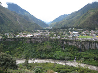
The town of Baños.
Riobamba, without a doubt, has been (and continues to be) the highlight of my time in Ecuador thus far.
On Sunday I took a bus from Baños to the nearby of city of Riobamba. I had coordinated my visit with a friend, Emily Webster, a Peace Corps volunteer who I knew from Costa Rica that had extended a third-year in Ecuador.
Emily (shown at the start of page) is living in Cacha, a set of indigenous communities in the mountains about 10 kilometers south of Riobamba. She has been there about 8 months in the community, working on environmental conservation initiatives, and a range of other things.
I had contacted Emily about three months before, letting her know I would be traveling in her area and would love to meet up. I wasn´t going to miss an opportunity to have an authentic in-country experience visiting a Peace Corps friend.
Fortunately, Emily was receptive to the idea, and so we coordinated our rendevous in the Riobamba centro across from the train station.
After exchanging hugs and some catching-up conversation, Emily showed me around Riobamba, the regional hub. It´s a fairly nice city, with around 250,000 people. As we toured the city, we ran into a group of American medical students who were in the area providing assistance to some of the local indigenous communities for a month during their summer break. Emily was familiar with them, and they were to pop up time and time again during our next few days.
Getting dark, we finally hailed a cab to take us out to Cacha. It was roughly a 25 minute cab ride, but only ended up costing us about $4.(again with the low prices)
Over the next two days I was able to get a feel for Cacha, as well as Emily´s lifestyle in her site.
With none of the local dwellings meeting Peace Corps standards for homestays, Emily was housed in the local casa communal, or community house. She has running water (although not potable), electricity, a propane gas stove, and a sink (but no shower). On a daily basis, she resorts to cold water bucket showers, and the occasional hot water shower at a home in a nearby town once or twice a week.
The primary language spoken in Cacha is Quichua, a variant of Quechua, the Incan language spoken throughout the language. When I asked Emily if she had learned much Quichua, she demurred and said that she hadn´t learned much. After watching her interact with some of her neighbors that first day, I learned she was just being modest, as I listened to her banter on in Quichua.
The language was fascinating to me. Being a student of the Spanish language, I habitually listened intently to the conversation, but found I understood absolutely nothing. Quichua is from another world...the world before there was a New World.
Emily would always revert back to Spanish after conversing for a little while, her Quichua limitations being reached. The indians spoke Spanish well, and so they would switch back to Spanish with her. Still...I found it amazing to listen to her speak Quichua.
I evened picked up a few words myself. Ashtakamen: See you later. Kayaykamen: see you tomorrow. And mashi, or friend. As the members of her community would invariably ask Emily if I was her husband, or boyfriend, finally coming to visit her. We would respond ¨mana(no), mashi¨.
We had timed my arrival to coincide with an indian activity to celebrate the first day of summer, which was set to take place on Monday. I was told the celebration would include a lot of indian rituals, complex ceremonies, and native foods. Naturally, I wasn´t going to miss this.
We woke up early on Monday and marched up to the top of the hill above the town, following other groups of people headed in the same direction. On reaching the site where the ceremony was to take place, we were surprised by what we found - gringos...quite a few of them.
But not just any gringos, these were some serious hippies, the likes of which I have not seen in all my Widespread Panic / Phish concert going years.
As we were to learn later, the gathering had been announced to religious shamans all throughout the Americas...and these norteamericano-looking people represented different groups in the US and Canada.
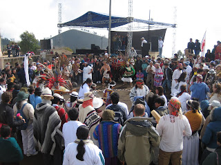
Ceremony, with shamans in the inner circle.
But I gotta be honest, to me they just looked like a bunch of hippies.
That really kind of threw me, and while watching the different rituals taking place, I just could not seem to wrap my head around there presence.
Before the ceremonies ended we walked down the hill to a number of food stands that had been set up featuring indigenous foods. Indigenous cuisine is pretty basic, mostly consisting of root vegetables and grains. The medical students volunteering in the area would constantly complain of the malnutrition of the patients they attended to.
There were other sad things happening within the community. Emily had told me how almost all the young adults had moved to the city, and sure enough during my two days I mostly saw little children and older adults. Also, there were lots of abandoned houses in the towns resulting from this exodus, which made for an eerie setting.
On Tuesday, Emily and I hiked up the hillside so I could see the school where she had been doing some work. Our visit coincided with a parents meeting. Emily and I began to work on a world map she had been completing on one of the schoolhouse walls. The start of the meeting was delayed, so many of the parents and kids hovered around us as we worked on the map, then picked up markers and lent a hand. It was fun to see everyone crowding around the map, looking at it with serious consideration.
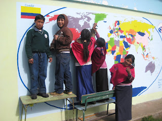
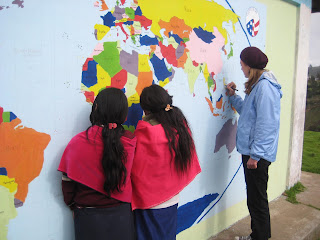
On Tuesday afternoon we came back down the mountain to Riobamba. It was to be my last night in Riobamba before heading farther south towards Peru.
But then, out at night with some of the medical students, over beers one of them suggested to me ¨Why don´t you climb Chimborazo!?¨ That majestic mountain, the highest in the country at 6300 meters, had been staring down at me for the last few days.
I decided it wasn´t a bad idea. Or that is, after shaking off a hangover the next day, decided it still wasn´t a bad idea. So I consulted a guide, who agreed to take me up the mountain. Tomorrow we have a practice / acclimatization hike, then Saturday we begin our ascent. If all goes well, after a few hours rest in a shelter in the afternoon, we will hike through the night and reach the summit around 6am on Sunday.
So it looks like I will be sticking around Riobamba a little longer.
Wednesday, June 16, 2010
Bogotá...and some commentary on Colombia
As expected, Bogotá, turned out to be even bigger and more sophisticated than Medellín. For the most part, I spent 3 very tranquilo days walking around the old section of the city, La Candelaria, where my hostel was located.
One of the most important landmarks in Bogotá is without a doubt Plaza de Bolivar (shown above). It´s an impressive square enclosed by the Supreme Court building, a cathedral, the Senate building, and the municipality offices. It was a nice place for people watching.
My first full day in the city I visited the Botero Musueum, an art collection whose primary works displayed are the paintings of Fernando Botero, Colombia´s most famous artist.
I´m not always a huge art fan, but I really liked his paintings. He´s most famous because of how he plays with dimensions in his paintings, most notably by making people and objects look fat or inflated. Case in point below.

In this painting you´ve got a really fat woman, lying on a very wide bed, with almost no space left elsewhere in the room to even walk, and she´s reading a letter from a lover and crying, all the while eating these silly, fat looking orange slices. It´s pretty hilarious.
The shapes, dimensions, and colors make his paintings a lot of...well...fun.
Also during my time in Bogotá I took a train up the mountainside behind the city to the Monserrat monastery which overlooks the capital. The view from there really gives you a healthy respect for the sprawl of Bogotá and it´s 7.5 million inhabitants.
Yesterday (Tuesday), I took a quick day trip two hours outside of the city to a town called Zipaquirá. Zipaquirá is nestled alongside a mountain that is basically pure salt underneath. It has been used to extract salt since the 7th century, when the indigenous began gathering the salt water that ran from under the mountain and drying it out to form salt cakes.
The mine is famous today because a huge cathedral capable of fitting more than 7 thousand people has been built roughly 200 meters underground in the old mine shafts.
It´s supposedly the #1 tourist attraction in all of Colombia, and was definitely pretty impressive. We walked along with a guide more than 2 kilometers down the mine shafts to reach the cathedral.
In the afternoon, I came back into town on the Transmilenio public transportation system, or basically a huge line of buses that shuttle people throughout the city via dedicated lanes that only they can use. It´s no underground, but I found the system pretty impressive.
Once back in the city, I checked out the Gold Museum, run by the National Bank. It is one of the largest collections of gold in the world, mostly from indigenous sites located within the country.
So I stayed pretty busy during my time in Bogotá. I think I was trying to get back to the basics after our partying in Medellín.
Still, I managed to stay at a very active hostel, and every day found myself sitting down for beers to watch a World Cup match or the NBA finals.
Colombia´s History of Violence
I´ve been meaning to write some kind of commentary on the state of things in Colombia...so here goes.
Colombia has a pretty bad image as a very dangerous place to live or travel, and with good reason. It´s important to understand the country´s past to better understand what is happening now in Colombia.
I´ll only go as far back as 1948, when the Liberal presidential candidate Jorge Eliécer Gaitán was poised to come to power, with a promise to unite the people of Colombia. Imagine someone with three times the charisma and popularity of Obama in a period of tense, uncertain times.
On April 9, 1948 Gaitán was assasinated while walking out of his law offices, unleashing massive riots in Bogotá. This unleashed a bloody conflict between Liberals and Conservatives throughout the country from the late 1940´s to early 1950´s, resulting in the deaths of more than 180,000 people. The period is simply called La Violencia.
In the late 1950´s a fragile peace was finally reached, but it could not stop the rise of guerilla groups, the most famous of which is the left-wing Fuerzas Armadas Revolucionarias de Colombia, or the FARC.
In Colombia, the central goverment has a long history of not being able to extend control over it´s own borders. Or that is, to provide even basic security throughout the country. You can understand why this is once you realize Colombia is the size of Texas and California combined, and thick with jungle, mountains, rivers, and many hideouts for guerilla movements.
So the left-wing FARC and conservative central government waged what amounts to a constant civil war for decades. Bad, right? It gets much worse.
In response to the central governments inability to crush the FARC and left wing groups, rich landowners and members of the oligarchy took matters in their own hands, raising private armies known as paramilitaries.
These paramilitaries were allowed to operate in certain areas of the country against the FARC with the tacit approval of the national army forces. But as you can imagine the paramilitaries soon resorted to some very shady practices, such as organizing outright ¨death squads¨ to pass through areas known to harbor FARC forces, and eliminate suspected collaborators. (some members of a small village Derek and I visited outside Valledupar told us of past visits and killings by paramilitaries in that area)
So the country was now swarming with government forces, the left wing FARC, and right wing paramilitaries. The advent of cocaine in the 1970´s heated things up even more.
Once the size of the cocaine market became evident, cocaine cartel leaders began making hundereds of millions and investing them in their own set of armed groups and hired assassins.
As the FARC and even right-wing paramilitaries became aware of the huge potential profits, they too began operating in cocaine production to finance their organizations. Pretty soon the right wing paramilitaries had completely shaken free of their masters and become an end unto themselves. Following the fall of the Soviet Union and the drying up of it´s funding sources, the FARC would also take on cocaine production (not too mention kidnapping) as it´s primary financing mechanism.
It can probably be safely said that rock bottom was reached on November 6, 1985, when the Palace of Justice (or the building which houses the Supreme Court) was raided by the left-wing armed group M-19. More than 300 lawyers, judges, and administrators were taken hostage by 35 M-19 guerrilla fighters.
The building was surrounded by the national army forces, and after hearing the demands of M-19 and determining that negotiating or giving in to the group´s demands would only further weaken the government, it was decided the army would be allowed to try to remove the rebels by force.
During the raid by government forces, the Palace of Justice caught fire, and more than 100 hostages were killed, including 11 of the country´s 21 Supreme Court Justices.
Stepping back for a moment...Can you imagine what that would be like? It would be as if an armed group suddenly raided the US Supreme Court and killed four out of the nine justices.
Between the M-19 raid and assassinations of judges and lawyers by cocaine cartels, the Colombian justice system was effectively crippled. It took years for the justice system to regain it´s strength.
Assasinations of political officials (including the 1989 Presidential candidate) continued to afflict the government throughout the 1980s and 90s.
Why does all this matter? The point of this review of Colombian violence is not to romanticize or glorify any of this. Quite the opposite, the real reason is I personally simply can´t imagine violence of that scale.
It´s also important to taking into account the present circumstances in Colombia. The eight years of Alvaro Uribe´s presidency have seen incredible changes in the security conditions around the country.
Uribe´s government effectively cleansed itself of some corrupt elements, waged absolute war against the FARC and other groups that couldn´t be negotiated with, and also coordinated negotiated surrenders with many right-wing groups.
It has not always been pretty or clean. Many people argue (probably correctly) that some paramilitaries have been able to literally get away with murder.
However the changes speak for themselves. The number of yearly kidnappings has dropped from 3,700 in the year 2000, to less than 175 in the 2009. FARC, the only remaining active rebel movement, has dropped from a force of 16,900 to 8,900. More importantly, the have been pushed deep into the mountains and cannot strike at vital regions in the center of the country.
The last 8 years have seen Colombia rescued from a nightmare, and it appears ready to experience a boom - especially economically. During the next 5 to 10 years, I expect the country to become a major tourist destination. I´m really happy to have been able to travel in Colombia some before word gets out, and the masses come flooding in.
Culturally, Colombia has always been a regional leader - with writers such as Gabriel García Marquez, musicians like Juanes and Shakira, and it´s impressive architecture and art in it´s cities. However, in the future, look for Colombia´s image to change in a big way.
I think that about does it for my Colombia rant.
Quito, Ecuador
This morning I arrived in Quito, Ecuador after flying Bogotá. I´ll be in Ecuador roughly two weeks. One of the highlights that I´m really looking forward to is visiting a Peace Corps friend from Costa Rica who extended her service for 1 year here in Ecuador. This weekend I plan to visit her in her community (high in the mountains) and be around for an indigenous festival celebrating the first day of summer. Should be pretty awesome.
Subscribe to:
Posts (Atom)
